cuspera logo CUSPERA
Maptitude Mapping Software
Maptitude Mapping Software Field Sales 4.68 1,216 reviewer insights

Maptitude Mapping Software: Compliance Management and Business Mapping

Maptitude GIS and Mapping Software - caliper.com

Maptitude Mapping Software helps security teams manage compliance by providing tools for business mapping and analysis. Teams use it to create market maps and improve field staff routes by unifying location data. They also use it for financial stress mapping and visualization to analyze geographic patterns. For example, Maptitude mapping software helps a customer manage franchise territories for Carl's Jr. and Hardee's. The team uses Maptitude to unify location data, create market maps, and assign exclusive trade areas.

Is Maptitude Mapping Software right for your team? Compare with Espatial Mapping

Seen most for

Reported results

Typical customer

Small and large companies

67% of customer stories; 27% from management consulting.

What teams use Maptitude Mapping Software for

Explore Maptitude Mapping Software use cases grouped by customer job. Click a use case to read the supporting evidence, or open a job to see detailed results.

Job
How widely used
Use cases
Field Sales jobs
Territory and route planning CKE Restaurant Holdings, Inc., eXPD8 Analytics
Common use

Other use cases

Maptitude Mapping Software capabilities

Explore Maptitude Mapping Software capabilities and related topics most often mentioned in customer evidence. Click a capability to read the supporting evidence.

Who uses Maptitude Mapping Software

IndustriesAggregated usage insights
Management Consulting: 13%Government Administration: 13%Research: 12%Education: 11%Hospital & Health Care: 11%Other industries: 40%
  • Other industries40%
Company sizeAggregated usage insights
Small business: 45%Enterprise: 36%Mid-market: 19%
  • Small business45%
  • Enterprise36%
  • Mid-market19%

Maptitude Mapping Software customer stories

Results reported in published case studies.

Massachusetts Municipal Assessors Office (City name confidential)

Government Administration · Medium
+50% properties

Maptitude GIS software helped a Massachusetts municipal assessor’s office improve property inspection routes. The city needed to inspect every parcel every 10 years but struggled with ine...

Maptitude GIS software helped a Massachusetts municipal assessor’s office improve property inspection routes. The city needed to inspect every parcel every 10 years but struggled with inefficient, grid-based mapping. Maptitude enabled logical inspection zones and optimized driving routes. Inspectors covered about 50% more properties in the same time. The new system reduced travel, saved staff hours, and ensured compliance with state mandates.

State legislatures, political parties, and interest groups

Government Administration · Large

Maptitude for Redistricting helps state legislatures, political parties, and interest groups design political boundaries. The software supports compliance with federal requirements and st...

Maptitude for Redistricting helps state legislatures, political parties, and interest groups design political boundaries. The software supports compliance with federal requirements and state-specific standards. It enables users to create defensible and consistent redistricting plans. Maptitude provides tools for population equalization, compactness, and community integrity. It allows for non-partisan review and robust defense of new district maps.

GeoDataVision

Management Consulting · Small

Maptitude GIS software helped GeoDataVision streamline banking compliance mapping. The firm used Maptitude to integrate CRA and fair lending data for hundreds of banks. Interactive maps m...

Maptitude GIS software helped GeoDataVision streamline banking compliance mapping. The firm used Maptitude to integrate CRA and fair lending data for hundreds of banks. Interactive maps made it easy for clients and regulators to spot compliance gaps. Maptitude Online enabled real-time map sharing and collaboration. GeoDataVision saved time and reduced errors by consolidating data in one platform. Bank examiners praised the clarity and detail of the maps.

Aricia Logistics Consulting

Logistics · Small

Maptitude GIS helped Aricia Logistics Consulting analyze logistics networks. The software mapped customer locations, deliveries, and volumes. It used facility location tools, drive time z...

Maptitude GIS helped Aricia Logistics Consulting analyze logistics networks. The software mapped customer locations, deliveries, and volumes. It used facility location tools, drive time zones, and batch distance files. This enabled cost-effective network planning and scenario modeling. Maptitude supported strategic logistics decisions for better service and lower costs.

California Citizens Redistricting Commission (CRC)

Government Administration · Large

Maptitude for Redistricting helped the California Citizens Redistricting Commission redraw 177 districts in just eight months. The software enabled a fully open and public process, with o...

Maptitude for Redistricting helped the California Citizens Redistricting Commission redraw 177 districts in just eight months. The software enabled a fully open and public process, with over 2,000 group submissions and high transparency. A 2013 report found that more than 66% of informed voters approved the new district maps. Maptitude allowed the commission to meet population equality requirements and support public engagement. The solution increased trust and democratized redistricting in California.

Public Safety Strategies Group LLC (PSSG)

Management Consulting · Medium

Maptitude mapping software helped Public Safety Strategies Group LLC (PSSG) redraw police district boundaries for the San Francisco Police Department. PSSG used Maptitude to analyze data ...

Maptitude mapping software helped Public Safety Strategies Group LLC (PSSG) redraw police district boundaries for the San Francisco Police Department. PSSG used Maptitude to analyze data like calls for service, incidents, and response times. The software made it easy to create and compare new district maps. This improved district management and helped balance police workloads. Maptitude maps were shared with decision makers in a clear format.

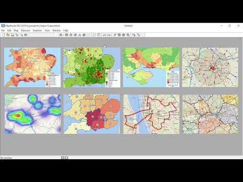
GIS & Mapping Software for UK +Ireland. How to map Excel data & customer locations

Video Thumbnail

Maptitude Mapping Software activities

From 1,216 reviewer insights.

Mentioned most

Rated highest and lowest

Compare Maptitude Mapping Software

All Maptitude Mapping Software alternatives →

Caliper Corporation News

Awards

Maptitude Developer Caliper Corporation Named to the Geoawesome Global Top 100 Geospatial Companies 2026

Caliper Corporation, the developer of Maptitude, has been recognized as one of the Geoawesome Global Top 100 Geospatial Companies for 2026. This accolade highlights Caliper's significant contributions to the geospatial industry.

Awards

Maptitude Developer Caliper Corporation Named to the Geoawesome Global Top 100 Geospatial Companies 2026 - MundoGEO

Caliper Corporation has been named to the Geoawesome Global Top 100 Geospatial Companies 2026. This recognition was decided by a community vote of over 125 geospatial professionals. Caliper, known for its Maptitude software, is one of 31 new entrants on the list, highlighting its impact in the geospatial industry.

Awards

Maptitude Developer Caliper Corporation Named to the Geoawesome …

Caliper Corporation, the developer of Maptitude, has been named to the Geoawesome Global Top 100 Geospatial Companies for 2026. This recognition, decided by over 125 geospatial professionals, highlights Caliper's impact in the GIS and mapping software industry.

Product

Caliper Releases TransModeler 8

Caliper has released TransModeler Version 8, enhancing its transportation simulation capabilities. The new version supports advanced simulation of signalized and multi-modal systems, introduces scalable microsimulation and dynamic traffic assignment, and offers new visualization tools. Key features include improved signal timing plans, integration with traffic signal controllers, and enhanced driver behavior models.

Frequently Asked Questions (FAQ)

What buyers ask before choosing Maptitude Mapping Software

What is Maptitude Mapping Software used for?

Maptitude Mapping Software is a Field Sales Software mainly used by its customers to Acquire Customers and Grow Market Share by Forecasting, Sending & Publishing Communications and Funnel Analysis .

What are the top features of Maptitude Mapping Software?

Recording, Personalization and Calculator are some of the top features of Maptitude Mapping Software.

Who uses Maptitude Mapping Software?

Maptitude Mapping Software is used by Research, Education and Hospital & Health Care among other industries.

What are Maptitude Mapping Software alternatives?

Espatial Mapping, Urva, Inzant Sales and Badger Maps are popular alternatives for Maptitude Mapping Software.

Where is Maptitude Mapping Software located?

Maptitude Mapping Software is headquartered at 500 Alexander Park, Suite 200, Princeton, New Jersey 08540, US.

Caliper Corporation Profile

Company Name

Caliper Corporation

Company Website

https://www.caliper.com/

HQ Location

500 Alexander Park, Suite 200, Princeton, New Jersey 08540, US

Social

Financials

PRIVATE